
Basemap is a backdrop context of any mapping layer as a geographical historic reference.
Basemap stores reference information of any area of interest. This area can be large or small. It stores different kinds of geospatial information. Question arises here, what cartographer is trying to propagate to the reader through the map.
Basemap requires great effort and time to build. Mostly large teams, including survey teams and heavy equipment enable organizations to build their basemaps.
Basemaps are important for all types of mapping. Even dynamic interactive maps required base maps for quick references and human understandings.
It is not fixed how many layers make a basemap. It depends on the needs of the project.
Let’s explore basemaps types and see some examples of web interactive basemaps.
Types of Basemap
Let’s suppose you are a film director, and shooting a scene for a film. You have characters on stage. These characters tell the story that you want to propagate to the audience. You tell your story through your main theme layers. And your stage theme is your basemap.
In the mapping world, there are six types of basemaps for general mapping.
Let’s discuss general types and find out which one is best fit for your next map.
| Basemap | Overview | Example |
| Satellite | Satellite Basemap is a backdrop aerial image in pixels taken by a satellite traveling around the area of interest.This is useful to observe quick changes in natural features of earth. Such as a quick reference map before and after Hurricane situations. | North Abaco, The Bahamas. Sep 20, 2017 – Land Viewer | EOS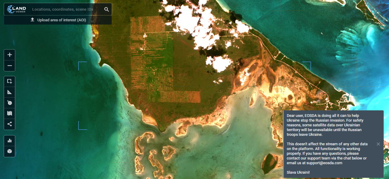 |
| Orthophoto | Orthophoto basemaps are orthorectified sums of images. They are usually created by satellite imagery, but can also be created with aerial or drone photography. | Google Earth 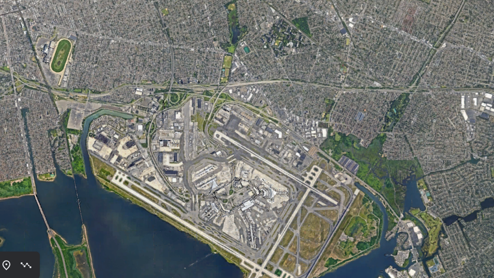 |
| Topographic | TTopographic Map is designed to be used as a basemap by GIS professionals and as a reference map by anyone. The map includes administrative boundaries, cities, water features, physiographic features, parks, landmarks, highways, roads, railways, and airports overlaid on land-cover and shaded relief imagery for added context. | Topo Base Map, Lookout MT and Tenn River | U.S. Geological Survey (usgs.gov)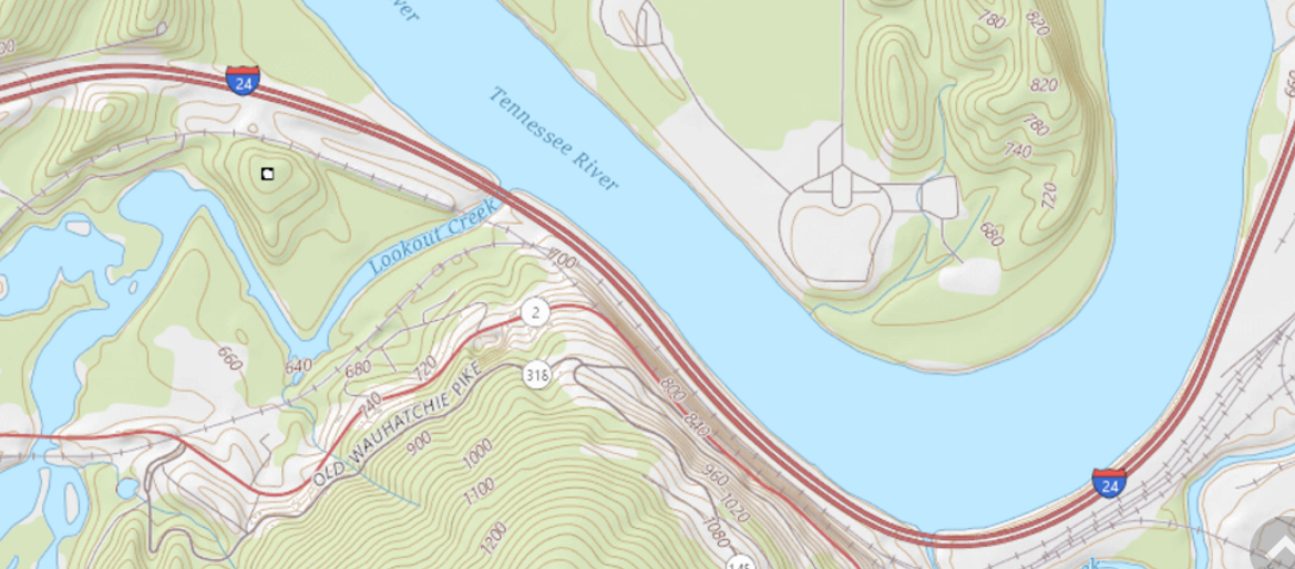 |
| Elevation or Contours | A digital elevation model, also known as a DEM, is a backdrop for elevation reference of any feature on earth. | Elvis (fsdf.org.au)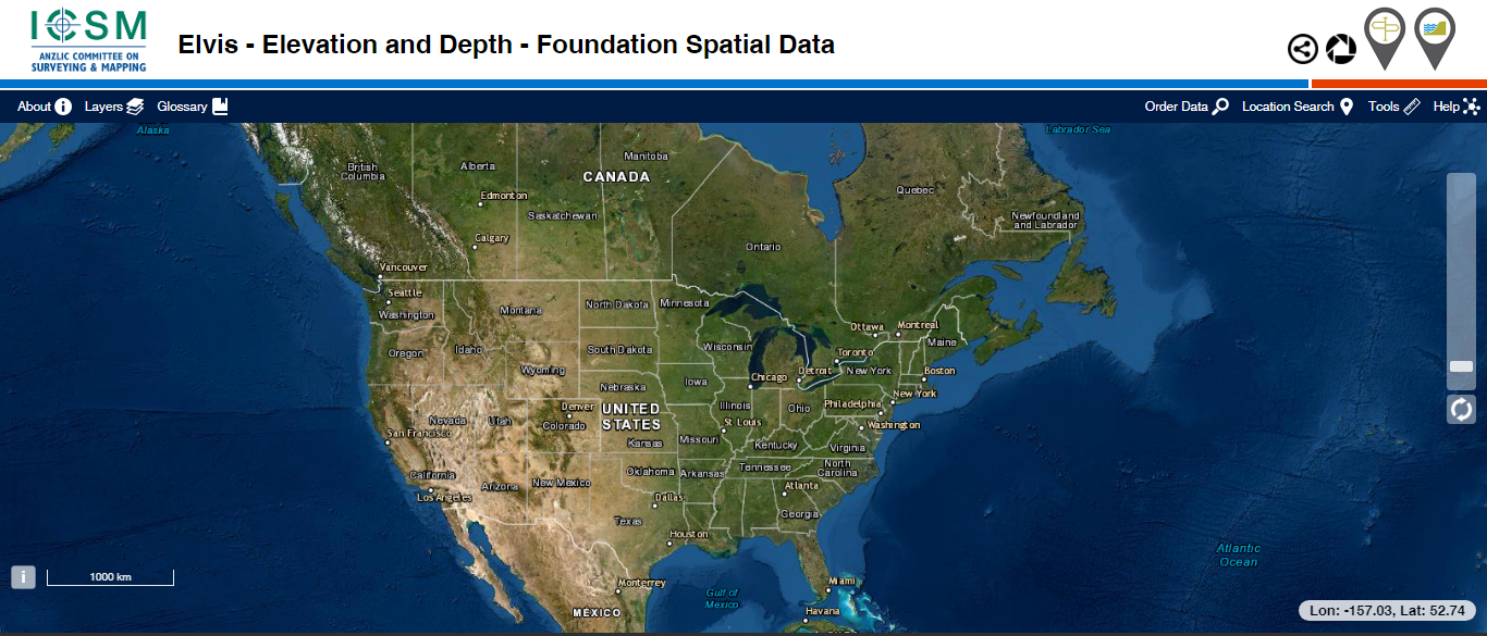 |
Conclusion
Basemaps are foundation for any map. Basemaps become mature with passage of time and plenty of survey activities.
Basemap makes it happen for your map readers to identify other nearby feature using reference background detail map containing other information.
Have you ever used any basemap?
Do you have any questions about basemaps?
Please let us know with a comment below.

